- Katılım
- 2 Eylül 2011
- Mesajlar
- 3,869
- Tepkime puanı
- 37
Adıyamanın ingilizce tanıtımı
ADIYAMAN province
ADIYAMAN
Area: 7614 km2
Population: 810.260
Traffic Code: 02
Districts:
ADIYAMAN
Adiyaman Province, part of the Middle Euphrates in Turkey is located at the west end of Güneydoğuanadolu. Adiyaman province on the southeast extension of the Taurus in the northern province of Malatya (Pütürge, Smalls and Doğanşehir district),
in the province of Kahramanmaras in the West (Central and Pazardzhik district), south-west of Gaziantep (district of your car), in southeastern Sanliurfa province

adıyaman harita
(Siverek, Hilvan, Bozova and Halfeti counties), east of the province of Diyarbakir (with Çermik Cungus county) are available.
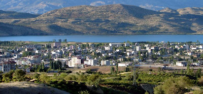
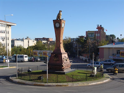
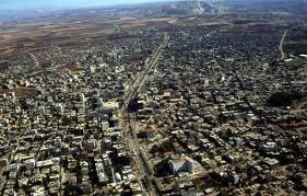
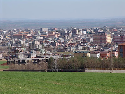
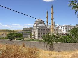
Adıyaman (the ancient Perre or Pordonnium) is a city in southeastern Turkey, capital of the Adıyaman Province. It is one of the fastest-growing cities in Turkey. The population rose from 100,045 (1990) to 178,538 (2000) (census figures).
Etymology
The city had the Arabic name 'Hisnimansur' officially until the year 1926, but as this name was difficult for Turks to pronounce, the people were referring the city as 'adi yaman' which means 'tough name' or '(the place) with the tough name' in Turkish. In 1926, this term was adopted as the official name of the city.
History
The area has been inhabited as far back as it's possible to discover. Research in the cave of Palanlı 10km north of Adıyaman show occupation in 40,000 BC and other digs in Samsat reveal continuous occupation through the stone and Bronze Ages.
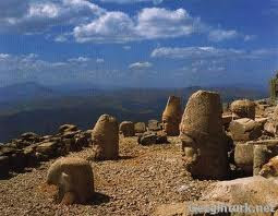
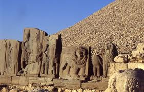
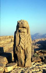
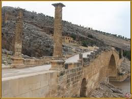
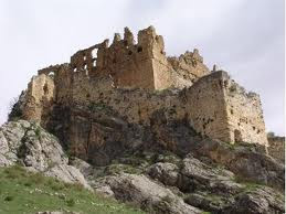
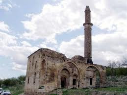
From 900BC onwards came waves of invasions from Assyrians, Persians, and Macedonians until the Commagene kingdom was founded in 69BC. This was the civilisation that built the statues on top of nearby Mount Nemrut. The capital was in Samsat (Samosata) but the town of Adıyaman was a walled city of the Commagenes. The city walls of Adıyaman have been restored and replaced many times since.
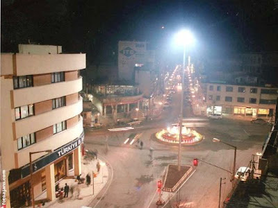
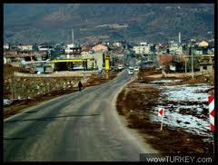
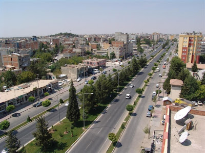
Adıyaman today
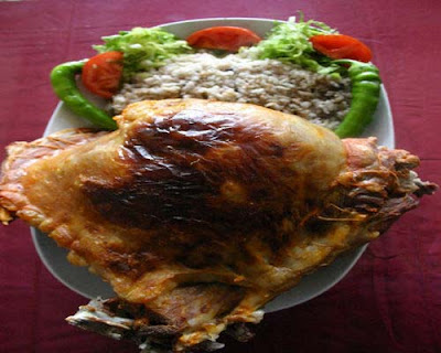
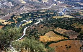
The city of Adıyaman provides shops and infrastructure to an agricultural region watered by the River Euphrates. It is not an industrial city, people riding mules and donkeys are still a common sight. The ******* reservoir is near the city and with more investment the irrigation this could become a richer agricultural zone. The people are religious and conservative; it is hard to find a beer in Adıyaman, or other social amenities like cafes, cinemas, and theatre. The cuisine is typical of south-east Turkey, including dishes like çiğ köfte and Maraş-style ice-cream.
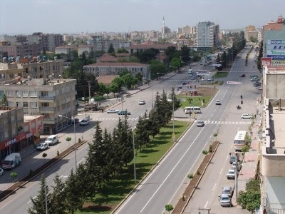
The Türkmen identity persisted into the 20th century although today Adıyaman is inhabited by a cosmopolitan mixture of people from other parts of Turkey. There is a small town feel to the place far warmer than the rambling mess that has become of bigger cities like nearby Urfa.
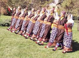
The folk dances of Adıyaman are well-known, (see for illustrations of the traditional costume).
Adıyamanspor are a minor league football team.
The Commagene kingdom lasted until the Romans came in 72AD. Yet more campaigns and invasions followed and Adıyaman was controlled by Byzantines 395-670, Ummayads from 670 and then Abbasids 758-926. Then the area returned to Byzantine control during the period of the Crusades 859-1114. The Arabs returned from 1114 to 1204 and finally came the arrival of the Turks. The Arabic name for the castle and town was Hısn-ı Mansur.
Turks moved into the area from 1114 onwards and for most of the 1200s was settled by the Selçuk Turks often disrupted by Mongol invasions. From 1298 to 1516 the town was under the control of the Mameluks. Adıyaman was brought into the Ottoman Empire by Selim i in 1516, but local power often rested with the Dulkadiroğulları tribe of Türkmen people that settled here
ADIYAMAN province
ADIYAMAN
Area: 7614 km2
Population: 810.260
Traffic Code: 02
Districts:
ADIYAMAN
Adiyaman Province, part of the Middle Euphrates in Turkey is located at the west end of Güneydoğuanadolu. Adiyaman province on the southeast extension of the Taurus in the northern province of Malatya (Pütürge, Smalls and Doğanşehir district),
in the province of Kahramanmaras in the West (Central and Pazardzhik district), south-west of Gaziantep (district of your car), in southeastern Sanliurfa province
adıyaman harita
(Siverek, Hilvan, Bozova and Halfeti counties), east of the province of Diyarbakir (with Çermik Cungus county) are available.
Adıyaman (the ancient Perre or Pordonnium) is a city in southeastern Turkey, capital of the Adıyaman Province. It is one of the fastest-growing cities in Turkey. The population rose from 100,045 (1990) to 178,538 (2000) (census figures).
Etymology
The city had the Arabic name 'Hisnimansur' officially until the year 1926, but as this name was difficult for Turks to pronounce, the people were referring the city as 'adi yaman' which means 'tough name' or '(the place) with the tough name' in Turkish. In 1926, this term was adopted as the official name of the city.
History
The area has been inhabited as far back as it's possible to discover. Research in the cave of Palanlı 10km north of Adıyaman show occupation in 40,000 BC and other digs in Samsat reveal continuous occupation through the stone and Bronze Ages.
From 900BC onwards came waves of invasions from Assyrians, Persians, and Macedonians until the Commagene kingdom was founded in 69BC. This was the civilisation that built the statues on top of nearby Mount Nemrut. The capital was in Samsat (Samosata) but the town of Adıyaman was a walled city of the Commagenes. The city walls of Adıyaman have been restored and replaced many times since.
Adıyaman today
The city of Adıyaman provides shops and infrastructure to an agricultural region watered by the River Euphrates. It is not an industrial city, people riding mules and donkeys are still a common sight. The ******* reservoir is near the city and with more investment the irrigation this could become a richer agricultural zone. The people are religious and conservative; it is hard to find a beer in Adıyaman, or other social amenities like cafes, cinemas, and theatre. The cuisine is typical of south-east Turkey, including dishes like çiğ köfte and Maraş-style ice-cream.
The Türkmen identity persisted into the 20th century although today Adıyaman is inhabited by a cosmopolitan mixture of people from other parts of Turkey. There is a small town feel to the place far warmer than the rambling mess that has become of bigger cities like nearby Urfa.
The folk dances of Adıyaman are well-known, (see for illustrations of the traditional costume).
Adıyamanspor are a minor league football team.
The Commagene kingdom lasted until the Romans came in 72AD. Yet more campaigns and invasions followed and Adıyaman was controlled by Byzantines 395-670, Ummayads from 670 and then Abbasids 758-926. Then the area returned to Byzantine control during the period of the Crusades 859-1114. The Arabs returned from 1114 to 1204 and finally came the arrival of the Turks. The Arabic name for the castle and town was Hısn-ı Mansur.
Turks moved into the area from 1114 onwards and for most of the 1200s was settled by the Selçuk Turks often disrupted by Mongol invasions. From 1298 to 1516 the town was under the control of the Mameluks. Adıyaman was brought into the Ottoman Empire by Selim i in 1516, but local power often rested with the Dulkadiroğulları tribe of Türkmen people that settled here